


Historic winter storm hits NM, ice storm hits TX/OK and Zeta to impact the Gulf States
- Lance Quackenbush

- Oct 26, 2020
- 4 min read
1. Ice storm impacts Southern Plains
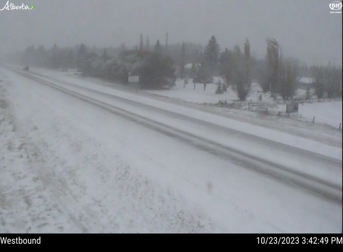
A sagging jet stream is over the Southern Plains of the United States causing an early season winter storm to affect the region. Two or more shots of moisture are expected for the region associated with shortwaves troughs, and an interaction with a cut off low over the Southwest US. Some storm spotters have already reported substantial freezing rain.
Winter weather advisories are in effect for parts of Kansas, Missouri and Colorado, with winter storm warnings in effect for northern Texas, the Oklahoma panhandle and parts of Colorado and New Mexico. The first is ongoing with freezing rain reported in Oklahoma City along with thunderstorms. An ice storm warning is in effect for Oklahoma as freezing rain from both shots of moisture looks to exceed 5-10mm in many areas, with locally up to 15+mm of freezing rain possible northwest of OKC. To the north and west of this zone, sleet and snow are expected or already occurring, with sleet and isolated freezing rain over North Texas. Snow will affect Kansas but will generally be light.

Across Colorado, New Mexico and the Texas/Oklahoma panhandles, heavy snow is expected as a cut-off low pumps moisture into a cold airmass, which will drop heavy snow over the next couple of days. There is some uncertainty, but 10-20+cm could occur over a wide area of the Texas and Oklahoma Panhandles, Northeastern New Mexico and Southeastern Colorado, with the highest amounts in the mountains. Snow has already been falling in Colorado, New Mexico and the Oklahoma Panhandle and reported by storm spotters.

Oklahoma
...ICE STORM WARNING IN EFFECT UNTIL 1 PM CDT WEDNESDAY... * WHAT...Periods of significant icing through at least Wednesday morning. Ice accumulations up to one-half inch will be common, with some locations possibly receiving upwards of one inch. There will also be accumulations of sleet. * WHERE...Central, northern, and southwest Oklahoma and western and northern Texas. * WHEN...Until 1 PM CDT Wednesday. * IMPACTS...Expect power outages and widespread tree damage due to the ice. Travel could become very dangerous. PRECAUTIONARY/PREPAREDNESS ACTIONS... Travel is strongly discouraged. If you must travel, keep an extra flashlight, food and water in your vehicle in case of an emergency. Prepare for possible power outages.
Texas
...WINTER WEATHER ADVISORY REMAINS IN EFFECT UNTIL 7 PM CDT THIS EVENING...
...WINTER STORM WARNING REMAINS IN EFFECT FROM 7 PM THIS EVENING TO 1 PM CDT WEDNESDAY... * WHAT...For the Winter Storm Warning, heavy mixed precipitation expected, primarily freezing rain and sleet. Total sleet accumulations of 1 to 2 inches and ice accumulations of a quarter to half inch. For the Winter Weather Advisory, freezing drizzle and light snow. * WHERE...The southeast Texas Panhandle and Rolling Plains. * WHEN...For the Winter Storm Warning, from 7 PM this evening to 1 PM CDT Wednesday. For the Winter Weather Advisory, until 7 PM CDT this evening. * IMPACTS...Travel could be very difficult. The hazardous conditions could impact the morning or evening commutes. PRECAUTIONARY/PREPAREDNESS ACTIONS... If you must travel, keep an extra flashlight, food, and water in your vehicle in case of an emergency. Slow down and use caution while traveling. Prepare for possible power outages.
2. Historic winter storm impacts New Mexico
...WINTER STORM WARNING REMAINS IN EFFECT UNTIL 6 AM MDT WEDNESDAY... * WHAT...Heavy snow expected. Total snow accumulations of 10 to 15 inches, except 4 to 8 inches in the Albuquerque metro area and west of the continental divide. Locally over 2 feet across the high peaks of the northern mountains. Winds gusting over 50 mph below canyons opening into the Middle Rio Grande Valley through this afternoon. * WHERE...Far Northwest and Northwest Highlands; West Central Mountains and Highlands; Jemez, Tusas, Sangre de Cristo Mountain, Sandia and Manzano Mountains; Middle and Upper Rio Grande Valley; Espanola Valley; Santa Fe Metro Area; and the Northeast and Far Northeast Highlands. * WHEN...Until 6 AM MDT Wednesday. * IMPACTS...Travel could be very difficult to impossible. Wind chill temperatures will drop into the single digits above and below zero tonight into early Tuesday morning. PRECAUTIONARY/PREPAREDNESS ACTIONS... If you must travel, keep an extra flashlight, food, and water in your vehicle in case of an emergency.

Area Forecast Discussion...UPDATED National Weather Service Albuquerque NM 1140 AM MDT Mon Oct 26 2020 .UPDATE... The potent winter storm continues to dig into the desert southwest, and snow is become more widespread. A very impressive cold air mass is in place as evident by 700mb temperatures below freezing for most. Very cold air will continue to move into the area, and as a result, most locations have likely already seen their high temperatures for today. Today`s high temperatures have been updated to trend them down to capture this. In addition, opted to upgrade the WW.Y to a Winter Storm Warning for the South Central Mountains as recent guidance suggests that they will receive 10" to 15" of snow through Wednesday. Updated products will be out shortly.

.DISCUSSION... .SHORT TERM...(TODAY THROUGH TUESDAY)... An epic and historic winter storm has descended upon the Land of Enchantment. Gone are the warm, dry days of the past five weeks. In its place is dramatically colder temperatures and widespread precipitation, mostly in the form of snow. The surface front spilled into the RGV overnight and continues west toward the Continental Divide this morning.

3. Tropical Storm Zeta

Another Tropical System formed in the western Caribbean (the 27th named Atlantic storm of the year) and is taking aim at the Yucatan Peninsula and the US Gulf Coast in the coming days just weeks after Hurricane Delta made landfall in western Louisiana.

As of 2pm EDT on Monday October 26th, Zeta was located SE of the Yucatan with 112 km/h winds. The storm is expected to make landfall Monday night southwest of Cancun, Mexico as a hurricane and regain strength in the Gulf of Mexico. A landfall to the Gulf Coast as a strong tropical storm or a hurricane will be likely by late Wednesday anywhere from Central Louisiana to the Florida Panhandle. This area along the coast will have to be monitored closely as tropical storm watches and warnings and hurricane watches or warnings will be issued late today or tomorrow.


Comments