
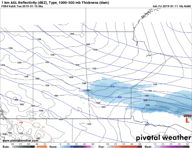
A Clipper will quickly swing through the Prairie Provinces on Monday night into Tuesday. The GIF above depicts latest model trends for the position of this Clipper (Low pressure system) on Tuesday morning. "Model trends" is exactly what it means, it depicts the latest way the model is trending. In this case, we are looking at the North American Mesoscale Model (NAM) in a 12-km grid resolution. The latest runs are showing some agreement with placing a Low pressure somewhere around Westman Monday night into Tuesday morning. This brings us to the extremely cold temperatures on the backside of the system.
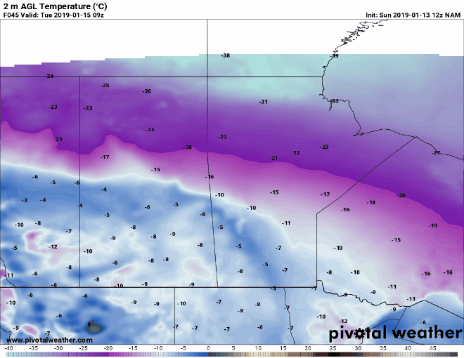
Temperatures in Celsius are depicted above from Tuesday to Wednesday showing extremely cold temperatures approaching the -30C. With the winds, wind chills will approach the -50's in Northern Manitoba and mid -30's in Southern Manitoba (depicted below).

Temperatures won't be much better down south of the border in North Dakota and Minnesota with dangerous wind chills on Wednesday (depicted above).

Love what we do? You can support us here: https://www.patreon.com/NZPChasers