
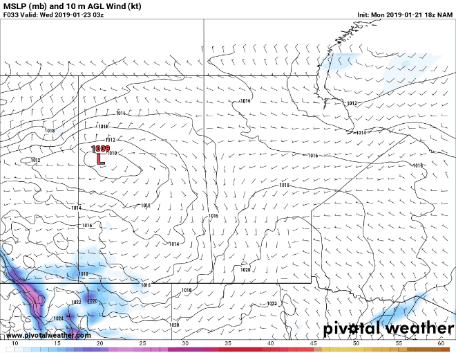
Unfortunately, not any good news for people of Manitoba. A low pressure will be responsible for bringing milder air today and tomorrow from the south into parts of the cold Prairie Provinces. However, that will be shortly lived as this same Clipper will drag cold Arctic air back into parts of Manitoba mid-week (see below).

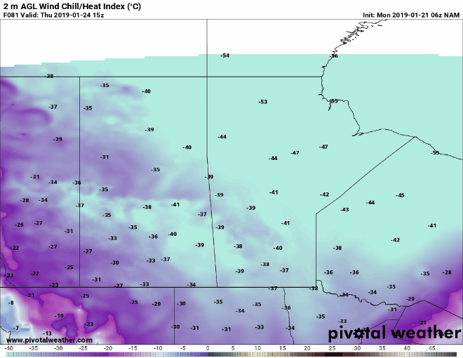
Model trends depict that there is general agreement between models for temperatures to approach -30C for parts of southern Manitoba and near -40C for parts of northern Manitoba (see below).

If we look at the wind chill values, they may be in the -50's once again for northern Manitoba and near -40 in the southern parts of the province. Wind chills depicted below:
-38 for Brandon, MB
-37 for Winnipeg, MB
-53 for Churchill, MB
-40 for Regina, SK
Extreme cold warnings are likely to return sometime on Wednesday for parts of the province ahead of this cold airmass. This cold airmass should last until at least early next week for Manitoba.

Like what we do? You can support us here: https://www.patreon.com/NZPChasers