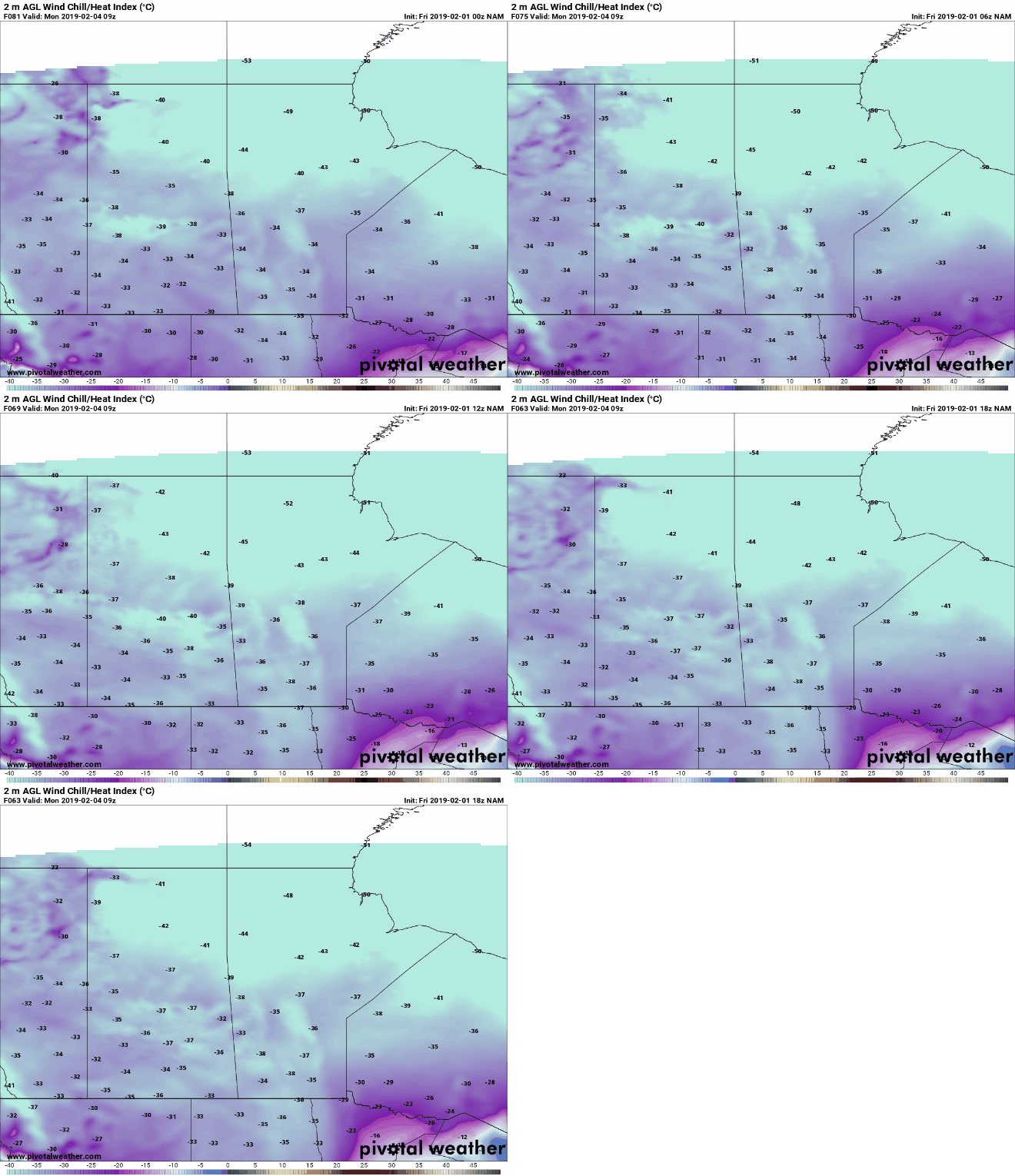
Arctic air is set to return to the Prairie Provinces following a brief warm-up in temperatures. A Clipper will swing through parts of central Saskatchewan and Manitoba tonight and tomorrow, bringing with it system snow. A cold Arctic airmass will slowly be dragged on its backside. However, it is the expected Colorado Low, which is forecasted to bring winter storm conditions to the Northern Plains on Monday that will allow the Arctic air to move southwards.
Above widget not working? Click here for our online store: https://www.nzpchasers.com/online-store

Cold temperatures will slowly return in the mid minus twenties, but the big story will be the wind. Extreme wind chills will return to the Prairies as the surface Low pressure depicted above moves northeast in the US Midwest.

This will only be the beginning of another long period of deep freeze for many areas of Canada and the United States as a High pressure (see below) locks in place over the Prairies and allow for another cold air outbreak.

Below is the North American continent and the surface temperatures (in F) several weeks into February. As you can see, another cold Arctic airmass will be locked in place, better known as the Polar Vortex.

Below is a screenshot of the forecasted surface temperatures for the Prairie Provinces by the NAM 12km model. As you can see, the temperatures themselves won't be too extreme, but strong northerly winds will bring dangerous wind chills nearing -40 (as shown in the beginning of this article).

Love what we do? You can become a supporter here: https://www.patreon.com/NZPChasers
