
Sunday November 22nd, 2020
Threat level: HIGH
Impacts: HIGH (based on population density)
Confidence: Moderate-High (based on model agreements)
Expected hazards: Heavy Snow and Wet Snow
Expected snowfall: 5-15cm, locally higher
Time frame: Starting Sunday afternoon Nov 22nd for Southwestern Ontario into Monday Morning Nov 23rd
Locations impacted: Southern, Central, and Eastern Ontario
Expected watch: special weather statements, with the possibility of winter storm watches for harder hit areas
Most likely areas impacted: Greater Toronto Area, National Capital Region, Central Ontario

Discussion: A low pressure system will form over the central United States and track northeastward into the Great Lakes region by the second half of the weekend. Models agree that a zone of wet snow will set up for Southern Ontario as the low center will remain south of the international border on Sunday. This will keep the region out of the warm sector, which will leave temperatures just above the freezing mark on Sunday with colder air aloft. The result will be wet snow for a large area, though there is a bit of uncertainty as to where the low will move, with the NAM taking the farthest south track and the American Model taking the farthest north track.
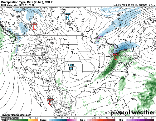
Moisture will be abundant, with over 25mm of total precipitation possible in the hardest hit regions, though this will incorporate rain and not be all snow. At this time, it appears that areas near Lake Erie and into the Niagara region will be where the rain snow line sets up. Precipitation may start out as rain and transition to snow, or could be mixed for a period of time. Areas closest to Lake Erie and Ontario will see some temperature moderation due to lake influence, which should keep snowfall totals down some. Areas above the escarpments will be cooler and should see more snow. Southwestern Ontario should see primarily rain, though minor accumulations of snow will be possible (2cm or less). To the north of these regions, the dominant precipitation type should be a rain/snow mix or snow, which could be heavy and wet as temperatures will be hovering at or just above the freezing mark for most of the event.

The big question mark will be the track though. If the track is farther south like the NAM is predicting, the Niagara region could see heavier snowfall of up to 10-15cm, as well as the highway 401 corridor in eastern Ontario. If the track is more along the average track of the global and regional models, then the heaviest snows could occur north of the GTA where up to 10 to locally 15cm of snow will be possible from a line around Guelph into the Ottawa area. Areas around Ottawa could also see 15cm, locally higher. Once again, areas on the direct lake shores of Lake Erie and Ontario should see less snow under all scenarios due to the lake moderating temperatures, which should allow for some rain instead of snow.
Bottom Line:
The first winter storm of the year is likely this weekend. The exact storm track has a bit of uncertainty, however it will be a moderate to high impact storm as snowfall amounts could reach or exceed 15 cm in places. Make sure to drive safely if you must go out and get those winter tires on too! Make sure to stay tuned for possible watches, warnings and weather statements from Environment Canada.