
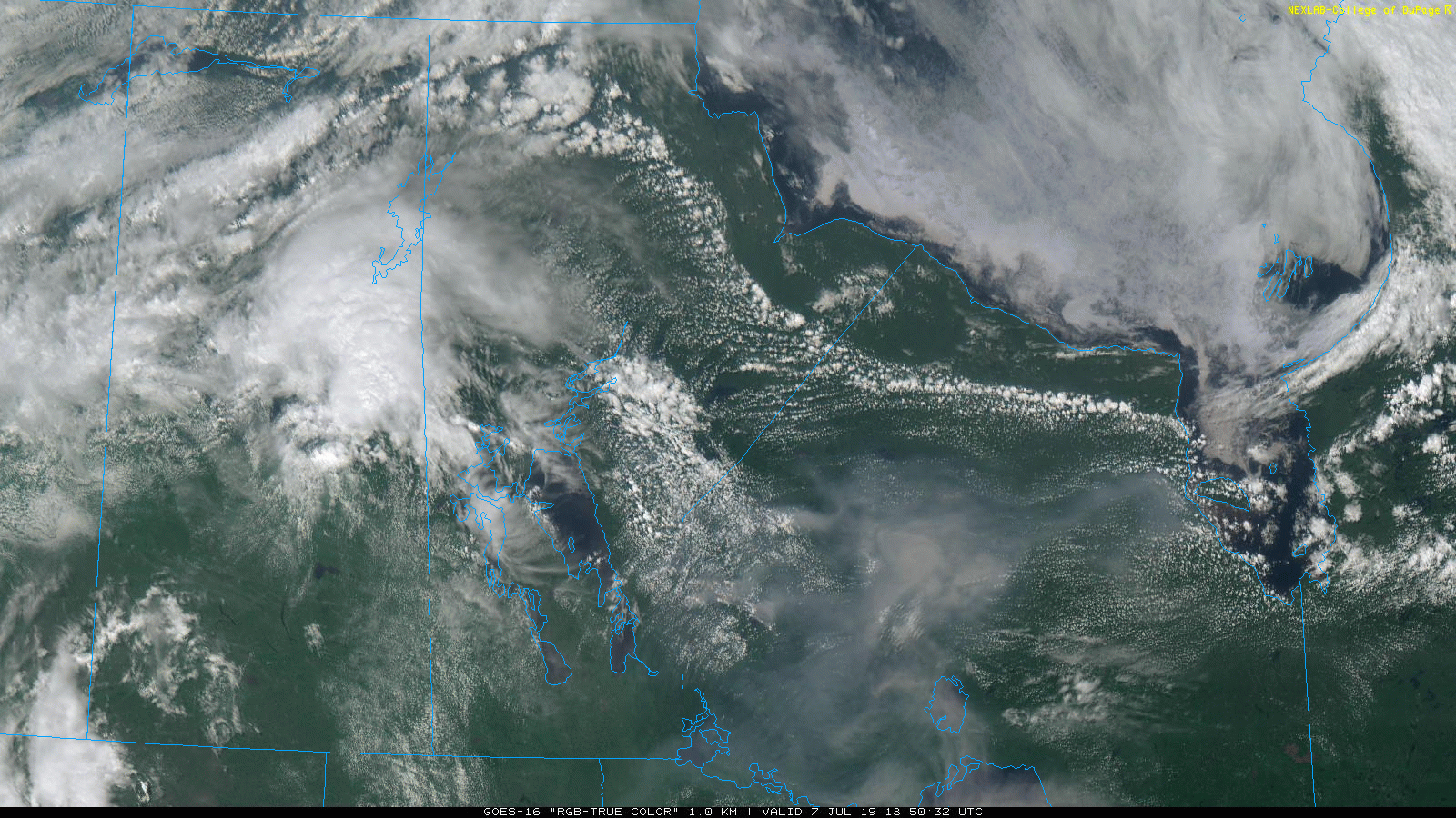
Check out this satellite depiction of a massive storm froming over Melfort, Saskatchewan and moving towards The Pas in Manitoba. According to Environment Canada:
At 4:27 p.m. CDT, Environment Canada meteorologists are tracking a line of severe thunderstorms capable of producing very strong wind gusts, nickel to ping pong ball size hail and heavy rain. A large line of thunderstorms is slowly crossing the Saskatchewan border late this afternoon. These thunderstorms have a history of producing large hail, severe wind gusts, and intense lightning.
Check out the live video update we did above about current storms in Saskatchewan and Manitoba. Here are the current watches/warnings as of 5:23pm CDT:

Warnings
4:27 PM CDT Sunday 07 July 2019 Severe thunderstorm warning in effect for:
The Pas Cormorant Westray and Wanless
At 4:27 p.m. CDT, Environment Canada meteorologists are tracking a line of severe thunderstorms capable of producing very strong wind gusts, nickel to ping pong ball size hail and heavy rain.
A large line of thunderstorms is slowly crossing the Saskatchewan border late this afternoon. These thunderstorms have a history of producing large hail, severe wind gusts, and intense lightning. Take cover immediately, if threatening weather approaches. Intense lightning is likely with any thunderstorm that develops. Remember, severe thunderstorms can produce tornadoes. Lightning kills and injures Canadians every year. Remember, when thunder roars, go indoors!
Severe thunderstorm warnings are issued when imminent or occurring thunderstorms are likely to produce or are producing one or more of the following: large hail, damaging winds, torrential rainfall.