
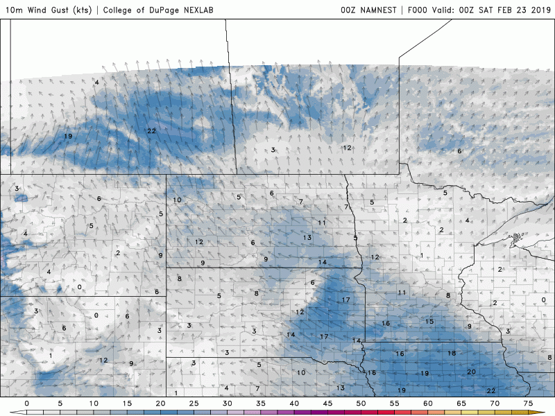
Above is an animation depicting wind gusts in the Red River Valley (in knots) for Saturday and Sunday. As you can see, strong winds are expected in southern Manitoba and the Northern Plains Saturday night into Sunday as a sharp cold front swings through the area. While only a few centimetres of snow is expected through the RRV, significant blowing snow will be possible, especially on Sunday. This will lead to "ground blizzard conditions".
What is a ground blizzard? According to the National Weather Service:
Ground blizzards are extremely dangerous because they are preceded by unseasonably warm air, which can cause people to let their guard down. People may venture outside without proper winter clothing. This relatively warm weather does not last long. The ground blizzard occurs when an Arctic cold front moves through the region, causing temperatures to drop and winds to increase, often reaching gusts of 50 to 60 mph. If there are several inches of deep fresh snow on the ground, this strong wind will quickly pick up the snow and create whiteout conditions. Another reason these blizzards are dangerous is the cold temperatures that follow behind the Arctic front. Anyone stranded in their vehicle or forced to walk outside is at risk of frostbite or hypothermia.

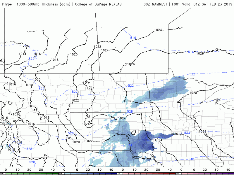
The below animation depicts the expected precipitation for the Red River Valley from Saturday through Monday morning. As a major Low pressure system departs, which will bring severe weather to the Deep South region of the United States, a cold front will be dragged across the forecast region.
Several major cities in Manitoba and North Dakota will be impacted by these conditions such as:
Winnpeg City (major blowing snow in open areas)
Pembina Border Crossing (major impacts)
Morris (major impacts)
Steinbach (major blowing snow in open areas)
Grand Forks (major impacts)
Brandon (minor impacts)
Any open areas in southeastern Manitoba will experience significant blowing snow starting Saturday night into Sunday. Major highways at risk early Sunday morning are:
Interstate 29 from the Canadian border (high risk, possible closures)
Hwy 75 from Winnipeg to the US border (high risk, possible closures)
Trans-Canada Highway between Portage La Prairie and Winnipeg (high risk of blowing snow)
Highway 3 from Winnipeg to Carman (moderate risk, possible closures)
Highway 2 from Winnipeg to Elm Creek (moderate risk, possible closures)

This Arctic front will bring a return to extremely cold temperatures to the Prairie Provinces and Northern Plains on Monday, with -30C temperatures and -40 wind chills expected to plague the area once more.

Love what we do? Become a supporter here: https://www.patreon.com/NZPChasers