

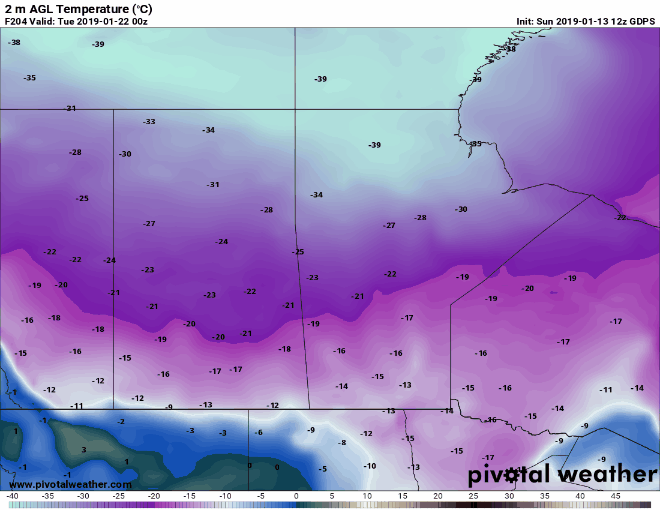
As we have discussed in our other blog post here (click), extremely cold temperatures are on the way for the Prairie Provinces starting Tuesday, but how long will it last? Above and below are depictions of surface temperatures (in Celsius) initiated by the GFS model. If we zoom on the Arctic airmass and focus only on the Prairies, we get the resulting outlook:

The Arctic airmass should sit on the continent for quite some time. This is not uncommon for this time of year. Starting Tuesday night, cold air intrusion will make its way towards the Northern Plains and stay there until at least the weekend, where a southerly flow may return. There is still a lot of discrepancy between models however. Below is a comparison between 3 different models showing a possible break in the Arctic airmass sometime on Monday January 21st, however not all models are agreeing.
Bottom line is, the Prairies and Northern Ontario are in for a prolonged period of extremely cold temperatures starting Tuesday night and lasting potentially into early next week. Make sure your car batteries are ready to go! Extreme cold warnings should be issued sometime tomorrow by Environment Canada.
Love what we do? Why not become a supporter here: https://www.patreon.com/NZPChasers